Found 64 OpenStreetMap tag(s).
Es wurde(n) 64 OpenStreetMap Tag(s) gefunden.
highway=path
Description:
Beschreibung:
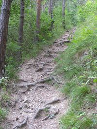
A generic path used by pedestrians, small vehicles, for animal riding or livestock walking. Not designated for use by two-track vehicles. Very broad, non-specific meaning.
Ein allgemeiner oder Mehrzweckweg für nicht-motorisierten Verkehr.
Implies:
Impliziert:
Combined with:
Kombiniert mit:
surface=*, access=*, lit=*, width=*, trail_visibility=*, segregated=*, foot=*, horse=*, smoothness=*, bicycle=*, name=*, sac_scale=*, mtb:scale=*
Weblinks in wiki:
Weblinks im Wiki:
smoothness=intermediate, mtb:scale=*, horse=permissive, highway=scramble, smoothness=*, surface=paved, surface=ground, cycleway:surface=asphalt, highway=cycleway, access=no, area:highway=path, bicycle=yes, foot=*, sac_scale=hiking, highway=track, foot=designated, foot=permissive, bicycle=no, lit=*, bicycle=designated, highway=via_ferrata, highway=service, width=1, mofa=yes, name=*, motor_vehicle=no, segregated=yes, access=*, footway:surface=paving_stones, trail_visibility=*, highway=footway, access=private, bicycle=*, foot=yes, highway=path, vehicle=no, surface=*, width=*, highway=bridleway, segregated=*, horse=no, horse=*, path=desire, sac_scale=*
Related terms:
Verwandte Begriffe:
path
Pfad
path=✱
Description:
Beschreibung:
-
-
Implies:
Impliziert:
Combined with:
Kombiniert mit:
Weblinks in wiki:
Weblinks im Wiki:
Related terms:
Verwandte Begriffe:
-
-
golf=path
Description:
Beschreibung:
Walking Route Common in Links Style Golf.
Wanderroute gemeinsam in Links Style Golf. (Übersetzung)
Implies:
Impliziert:
Combined with:
Kombiniert mit:
Weblinks in wiki:
Weblinks im Wiki:
golf=*, highway=path, foot=designated, golf=path, leisure=golf_course, highway=footway
Related terms:
Verwandte Begriffe:
-
-
footway=path
Description:
Beschreibung:
Used for pedestrian paths not linked to roads.
Wird für Fusswege verwendet, die nicht mit Strassen verbunden sind.
Implies:
Impliziert:
Combined with:
Kombiniert mit:
Weblinks in wiki:
Weblinks im Wiki:
footway=sidewalk, highway=footway, footway=path
Related terms:
Verwandte Begriffe:
-
-
path=sidewalk
Description:
Beschreibung:
Sidewalks as separate ways
Gehwege als separate Wege
Implies:
Impliziert:
Combined with:
Kombiniert mit:
Weblinks in wiki:
Weblinks im Wiki:
highway=construction, highway=path, path=*, construction=path, path=sidewalk, highway=footway, footway=sidewalk, sidewalk=*
Related terms:
Verwandte Begriffe:
-
-
construction=path
Description:
Beschreibung:
-
-
Implies:
Impliziert:
Combined with:
Kombiniert mit:
Weblinks in wiki:
Weblinks im Wiki:
Related terms:
Verwandte Begriffe:
-
-
area:highway=path
Description:
Beschreibung:
An area representation of paths.
Eine Flächenrepräsentation von Pfaden. (Übersetzung)
Implies:
Impliziert:
Combined with:
Kombiniert mit:
Weblinks in wiki:
Weblinks im Wiki:
highway=footway, cycleway=crossing, area:highway=footway, highway=path, segregated=yes, area=yes, junction=yes, landuse=grass, area:highway=cycleway, area:highway=*, bicycle=designated, leisure=garden, segregated=no, footway=crossing, type=multipolygon, surface=*, foot=designated, traffic_calming=island, highway=cycleway, area:highway=primary, area:highway=path, path=crossing
Related terms:
Verwandte Begriffe:
-
-
wikimedia_commons:path=✱
Description:
Beschreibung:
Draws a line over specified wikimedia_commons image.
-
Implies:
Impliziert:
Combined with:
Kombiniert mit:
Weblinks in wiki:
Weblinks im Wiki:
wikimedia_commons2=*, climbing=route_bottom, wikimedia_commons=*, climbing=route
Related terms:
Verwandte Begriffe:
-
-
path=traffic_island
Description:
Beschreibung:
-
-
Implies:
Impliziert:
Combined with:
Kombiniert mit:
Weblinks in wiki:
Weblinks im Wiki:
Related terms:
Verwandte Begriffe:
-
-
path=trail
Description:
Beschreibung:
Countryside path primarily intended for recreational walking, hiking, or running.
Landschaftsweg, das hauptsächlich für Freizeitspaziergänge, Wandern oder Laufen bestimmt ist. (Übersetzung)
Implies:
Impliziert:
Combined with:
Kombiniert mit:
est_width=*, width=*, incline=*, surface=*, smoothness=*
Weblinks in wiki:
Weblinks im Wiki:
est_width=*, highway=path, width=*, incline=*, surface=*, smoothness=*, path=trail
Related terms:
Verwandte Begriffe:
-
-
path=mtb
Description:
Beschreibung:
Type of path primarily intended for recreational mountain biking.
Art des Pfades, der hauptsächlich zum Freizeitbergbiken bestimmt ist. (Übersetzung)
Implies:
Impliziert:
Combined with:
Kombiniert mit:
width=*, surface=*, incline=*, est_width=*
Weblinks in wiki:
Weblinks im Wiki:
surface=*, incline=*, est_width=*, bicycle=yes, width=*, highway=path, path=mtb
Related terms:
Verwandte Begriffe:
-
-
healthcare:speciality=pathology
Description:
Beschreibung:
Medical specialty concerning the diagnosis of disease based on the macroscopic, microscopic, biochemical, immunologic and molecular examination of organs and tissues.
Medizinische Spezialität in Bezug auf die Diagnose von Krankheiten auf der Grundlage der makroskopischen, mikroskopischen, biochemischen, immunologischen und molekularen Untersuchung von Organen und Geweben. (Übersetzung)
Implies:
Impliziert:
Combined with:
Kombiniert mit:
Weblinks in wiki:
Weblinks im Wiki:
Related terms:
Verwandte Begriffe:
-
-
healthcare:speciality=clinical_pathology
Description:
Beschreibung:
Medical specialty concerning the diagnosis of disease based on the laboratory analysis of bodily fluids, such as blood, urine, and tissue homogenates or extracts using the tools of chemistry, microbiology, hematology and molecular pathology.
Medizinische Spezialität in Bezug auf die Diagnose von Krankheiten aufgrund der Laboranalyse von Körperflüssigkeiten wie Blut, Urin und Gewebehomogenaten oder Extrakten unter Verwendung der Werkzeuge Chemie, Mikrobiologie, Hämatologie und molekularer Pathologie. (Übersetzung)
Implies:
Impliziert:
Combined with:
Kombiniert mit:
Weblinks in wiki:
Weblinks im Wiki:
Related terms:
Verwandte Begriffe:
-
-
historic=mass_path
Description:
Beschreibung:
Use on relations to combine highways into a mass path.
Verwenden Sie in Beziehungen, um Autobahnen zu einem Massenweg zu kombinieren. (Übersetzung)
Implies:
Impliziert:
Combined with:
Kombiniert mit:
Weblinks in wiki:
Weblinks im Wiki:
loc_name=*, disused:highway=*, description=*, was:highway=*, wikidata=*, source=*, access=*, place_of_worship=mass_rock, wikimedia_commons=*, website=*, name=*, route=walking, was:route=walking, historic=mass_path
Related terms:
Verwandte Begriffe:
-
-
highway=cycleway
Description:
Beschreibung:
For designated cycleways.
Ein ausgewiesener Fahrradweg
Implies:
Impliziert:
Combined with:
Kombiniert mit:
traffic_sign=*, name=*, access=*, segregated=*, width=*, lit=*, surface=*
Weblinks in wiki:
Weblinks im Wiki:
footway:surface=*, amenity=bicycle_repair_station, width=*, traffic_sign=AT:52.16, bicycle=designated, area:highway=cycleway, segregated=*, cycleway:surface=*, highway=path, segregated=no, foot=yes, lit=*, surface=*, sidewalk=*, bridge=yes, sidewalk=right, access=*, highway=*, oneway=yes, segregated=yes, cycleway=*, sidewalk=right/left/no, tunnel=yes, traffic_sign=NL:G12a, traffic_sign=*, traffic_sign=GB:956, traffic_sign=DE:240, foot=designated, foot=no, highway=cycleway, name=*
Related terms:
Verwandte Begriffe:
cycle path
Radweg
highway=bridleway
Description:
Beschreibung:
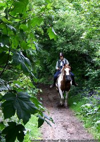
A way intended for use by equestrians.
Ausgewiesener Reitweg
Implies:
Impliziert:
foot=yes, motor_vehicle=no, bicycle=yes, horse=designated
Combined with:
Kombiniert mit:
Weblinks in wiki:
Weblinks im Wiki:
motor_vehicle=no, access=*, horse=yes, name=*, highway=bridleway, foot=yes, highway=path, highway=track, highway=*, bicycle=yes, horse=designated, designation=public_bridleway, route=horse, ref=*, network=*
Related terms:
Verwandte Begriffe:
bridle path, bridleway
Reitweg, Pferdeweg
highway=footway
Description:
Beschreibung:
A path mainly or exclusively for pedestrians.
Ein Weg, primär oder ausschliesslich für Fussgänger.
Implies:
Impliziert:
Combined with:
Kombiniert mit:
surface=*, name=*, covered=*, wheelchair=*, footway=*, tactile_paving=*, access=*, lit=*
Weblinks in wiki:
Weblinks im Wiki:
highway=pedestrian, tactile_paving=*, access=*, crossing_ref=*, highway=*, wheelchair=no, foot=designated, bicycle=*, footway=crossing, barrier=*, highway=corridor, covered=*, wheelchair=*, cycleway=*, highway=crossing, highway=path, surface=*, width=*, area=yes, informal=yes, highway=footway, area:highway=footway, landuse=*, name=*, barrier=kerb, footway=sidewalk, lit=*, crossing=*, footway=*
Related terms:
Verwandte Begriffe:
footway, sidewalk, foot path, pavement
Fussweg, Fussgängerweg, Bürgersteig, Fusssteig, Gehweg
route=✱
Description:
Beschreibung:
A customary or regular line of passage or travel, often predetermined and publicized.
Eine übliche oder regelmässige Fahrt- oder Reiseroute, die oft vorbestimmt und veröffentlicht ist
Implies:
Impliziert:
Combined with:
Kombiniert mit:
Weblinks in wiki:
Weblinks im Wiki:
route=ferry, route=*, access=*, route=foot, route=railway, route=tracks, type=route, route=horse, route=bicycle, route=piste
Related terms:
Verwandte Begriffe:
route, way, path, itinerary, line
Route, Strecke, Reiseweg, Richtung, Reiseroute, Kurs, Wegstrecke, Reiseplan
mtb:scale:imba=✱
Description:
Beschreibung:
A classification scheme for the difficulty of specifically designed trails for mountainbiking.
Schwierigkeitsskala für speziell angelegte MTB-Trails.
Implies:
Impliziert:
Combined with:
Kombiniert mit:
mtb:scale=*, mtb:scale:uphill=*, incline=*
Weblinks in wiki:
Weblinks im Wiki:
bridge=*, mtb:scale:imba=2, mtb:scale:imba=4, width=*, surface=*, tracktype=*, mtb:scale:imba=3, mtb:scale:imba=0, mtb:scale:imba=1, mtb:scale:uphill=*, incline=*, mtb:scale=*, smoothness=*
Related terms:
Verwandte Begriffe:
mountain-bike-scale, scale, obstacle, mountain-path, single-trail, skill, bends, uphill, gradient, test, driving skill, Trail Difficulty Rating System, mountain-track, surface, difficulty, downhill, bikeparks, mountain-bike
Mountainbike-Skala, Einstufungs-System, Fahrkönnen, bikeparc, Einstufung, Geländerad, Können, Schwierigkeit, Leisung, bergauf, Test, biken, Steigung, Level, bergab
route=foot
Description:
Beschreibung:
A signed walking Route
Spazierweg
Implies:
Impliziert:
Combined with:
Kombiniert mit:
roundtrip=yes, osmc:symbol=*, description=*, operator=*, symbol=*, wiki:symbol=*, distance=*, pilgrimage=yes, name=*
Weblinks in wiki:
Weblinks im Wiki:
network=*, route=hiking, wiki:symbol=*, operator=*, symbol=*, distance=*, pilgrimage=yes, roundtrip=yes, name=*, route=foot, osmc:symbol=*, description=*, type=route
Related terms:
Verwandte Begriffe:
foot route, foot hiking tour, easy hiking way
Fusswanderweg, Fusswegstrecke, Einfache Wanderroute
route=ferry
Description:
Beschreibung:
The route of a public ferry or water bus.
Die Route einer Fährlinie auf See oder in Binnengewässern
Implies:
Impliziert:
Combined with:
Kombiniert mit:
operator=*, motorcar=*, name=*, ferry=*, foot=*, from=*, network=*, duration=*, hgv=*, ref=*, to=*
Weblinks in wiki:
Weblinks im Wiki:
motorcar=*, access=*, foot=*, hgv=*, ferry=yes, capacity:bicycle=*, network=*, from=*, bicycle=*, name=*, man_made=pier, maxweight=*, route=*, motor_vehicle=*, duration=*, railway=*, maxlength=*, capacity=*, motorcycle=*, wheelchair=*, type=*, toll=*, fee=*, amenity=ferry_terminal, opening_hours=*, to=*, interval=*, ref=*, reservation=*, bridge=yes, ferry=*, route=ferry, maxheight=*, highway=*, ferry:cable=*, operator=*, type=route, maxwidth=*
Related terms:
Verwandte Begriffe:
ferry route
Fähre
rungs=✱
Description:
Beschreibung:
Rungs as safety measures in alpine hiking paths
Sprossen als Sicherheitsmassnahmen auf alpinen Wanderpfaden (Übersetzung)
Implies:
Impliziert:
Combined with:
Kombiniert mit:
sac_scale=*, height=*, highway=path
Weblinks in wiki:
Weblinks im Wiki:
wheelchair=no, ladder=*, rungs=yes, height=*, rungs=8, highway=path, highway=via_ferrata, sac_scale=*, safety_rope=*
Related terms:
Verwandte Begriffe:
rungs, hikingstep
Kletterhaken, Kletterhilfe, Steighilfe
highway=✱
Description:
Beschreibung:
Used for roads and road-related facilities.
Highway ist das Haupt-Attribut für Strassen und Wege aller Art.
Implies:
Impliziert:
Combined with:
Kombiniert mit:
Weblinks in wiki:
Weblinks im Wiki:
highway=*, highway=motorway, highway=trunk, highway=track, highway=motorway_link, highway=tertiary, highway=service, highway=primary, surface=*, tracktype=grade1, tracktype=*, surface=asphalt
Related terms:
Verwandte Begriffe:
highway
Strassen
bridge=✱
Description:
Beschreibung:
A bridge is an artificial construction that spans features such as roads, railways, paths, waterways or valleys and carries a road, railway or other feature.
Eine Brücke
Implies:
Impliziert:
Combined with:
Kombiniert mit:
railway=*, bridge:structure=*, layer=*, man_made=pipeline, highway=*, bridge:movable=*
Weblinks in wiki:
Weblinks im Wiki:
seamark:distance_mark:units=*, ref=*, maxaxleload=*, bridge=cantilever, bridge:ref=*, bridge:name=*, start_date=*, name=*, maxheight:physical=*, bridge:name=Merced River Bridge, bridge=viaduct, seamark:type=bridge, man_made=bridge, bridge=movable, seamark:bridge:clearance_height=*, tunnel=*, highway=construction, bridge:ref=40-47, man_made=pipeline, bridge:structure=*, abandoned:bridge=*, highway=*, access=*, bridge=yes, bridge=*, layer=1, bridge:movable=*, seamark:bridge:category=*, maxheight=*, old_name=*, bridge=trestle, abandoned=yes, seamark:distance_mark:distance=*, wikidata=*, proposed:bridge=*, construction=(highway-type), ford=*, seamark:bridge:clearance_width=*, wikimedia_commons=File:''name'', wikipedia=*, building=bridge, railway=*, embankment=*, bridge:support=*, maxlength=*, maxweight=*, layer=*
Related terms:
Verwandte Begriffe:
-
-
barrier=kerb
Description:
Beschreibung:
A stone edging to a pavement or raised path (right side is bottom, left side is top).
Bordstein als Randeinfassung von Verkehrsflächen
Implies:
Impliziert:
access=yes
Combined with:
Kombiniert mit:
height=*, wheelchair=*, kerb:height=*
Weblinks in wiki:
Weblinks im Wiki:
kerb:height=*, height=*, highway=residential, kerb=*, wheelchair=*, traffic_calming=table, barrier=kerb, barrier=step, highway=crossing, access=yes, footway=crossing, highway=footway
Related terms:
Verwandte Begriffe:
-
-
highway=steps
Description:
Beschreibung:
For flights of steps on footways and paths.
Treppen, die zu Fuss begangen werden.
Implies:
Impliziert:
foot=yes, access=no
Combined with:
Kombiniert mit:
step_count=*, conveying=*, incline=*, ramp=*
Weblinks in wiki:
Weblinks im Wiki:
access=no, platform_lift=*, conveying=*, barrier=step, ladder=*, conveying=yes/forward/backward/reversible, ramp=yes/automatic/manual, access=yes, surface=dirt, surface=*, wheelchair=no, ramp=*, flat_steps=*, conveying=yes, name=*, wheelchair=*, tactile_writing=*, barrier=handrail, lit=*, highway=ladder, highway=steps, material=rock, tactile_writing=yes/no, width=*, surface=rock, incline=*, handrail=no, tactile_writing:braille=yes, incline=up/down, tactile_paving=yes/(no)/incorrect, ramp=no, area:highway=steps, level=*, incline=up, handrail=*, highway=footway, step_count=*, material=wood, surface=brick, incline=down, foot=yes, handrail=yes, ramp=yes, level=0;1
Related terms:
Verwandte Begriffe:
steps, stairs, staircase
Treppe, Treppenrampe, Stufen
segregated=✱
Description:
Beschreibung:
Shows if a shared path is segregated or not.
Dieser Schlüssel gibt an, ob bei kombinierten Geh- und Radwegen eine Abtrennung vorhanden ist.
Implies:
Impliziert:
Combined with:
Kombiniert mit:
oneway=*, access=*, highway=cycleway/footway/path
Weblinks in wiki:
Weblinks im Wiki:
foot=designated, cycleway:surface=*, highway=cycleway/footway/path, cycleway:left=*, segregated=yes, foot=yes, oneway=*, shoulder=*, bicycle=designated, segregated=no, access=*, cycleway:right=*, sidewalk:left=yes, segregated=*, cycleway:separation=*, sidewalk:both=yes, sidewalk:right=yes, footway:surface=*, cycleway:both=*, sidewalk=left/right/both, sidewalk=*
Related terms:
Verwandte Begriffe:
-
-
surface=fine_gravel
Description:
Beschreibung:
Loose, small gravel, not compacted, typically used on paths and driveways with minimal traffic.
Splitt oder Grand
Implies:
Impliziert:
Combined with:
Kombiniert mit:
Weblinks in wiki:
Weblinks im Wiki:
surface=pebblestone, highway=*, surface=fine_gravel, surface=shells, smoothness=*, surface=compacted, surface=gravel
Related terms:
Verwandte Begriffe:
-
-
highway=construction
Description:
Beschreibung:
A highway (road, track or path) currently under construction.
Eine Strasse, die sich im Bau befindet
Implies:
Impliziert:
access=no
Combined with:
Kombiniert mit:
check_date=*, construction=*, opening_date=*
Weblinks in wiki:
Weblinks im Wiki:
highway=tertiary, motor_vehicle:conditional=no @ 2024 May 22-2024 Oct 7, surface=*, hazard=roadworks, bicycle=yes, opening_date=*, motor_vehicle=*, check_date=*, building=construction, tunnel=yes, note=*, proposed=*, construction=footpath, highway=construction, bridge=yes, access=no, landuse=construction, construction=road, construction=minor, foot=yes, highway=primary, construction=*, railway=construction, construction=primary, construction=tertiary
Related terms:
Verwandte Begriffe:
-
-
golf=hole
Description:
Beschreibung:
The path from tee area to the green
Eine Golfbahn
Implies:
Impliziert:
Combined with:
Kombiniert mit:
par=*, handicap=*, ref=*, name=*
Weblinks in wiki:
Weblinks im Wiki:
handicap=*, leisure=golf_course, golf=hole, ref=*, par=*, dist=*, name=*
Related terms:
Verwandte Begriffe:
-
-
golf=cartpath
Description:
Beschreibung:
Path for golf cart in golf course
Weg für Golfwagen im Golfplatz (Übersetzung)
Implies:
Impliziert:
Combined with:
Kombiniert mit:
Weblinks in wiki:
Weblinks im Wiki:
golf_cart=designated, highway=path, highway=service, golf=*, golf_cart=*, leisure=golf_course, golf=cartpath
Related terms:
Verwandte Begriffe:
-
-
cycleway=crossing
Description:
Beschreibung:
Indicates that a separately marked path is a road crossing for cyclists.
Gibt an, dass es sich bei einem separat gezeichneten Weg um eine Strassenquerung für Fahrradfahrer handelt.
Implies:
Impliziert:
Combined with:
Kombiniert mit:
Weblinks in wiki:
Weblinks im Wiki:
bicycle=designated, highway=footway, highway=cycleway, footway=crossing, cycleway=crossing, bicycle=yes, highway=path, highway=*
Related terms:
Verwandte Begriffe:
-
-
barrier=cycle_barrier
Description:
Beschreibung:
A barrier along a path that slows or prevents access for bicycle users.
Barriere entlang eines Weges, welche quer über den Weg positioniert ist, um den Zugang für Radfahrer zu erschweren oder zu verhindern.
Implies:
Impliziert:
Combined with:
Kombiniert mit:
opening=*, cycle_barrier=*, maxwidth:physical=*, wheelchair=*, cycle_barrier:installation=*, spacing=*, access=*, overlap=*
Weblinks in wiki:
Weblinks im Wiki:
cargo_bike=no, opening=1.2, bicycle=no, foot=yes, opening=*, access=*, moped=yes, wheelchair=no, cycle_barrier:installation=openable, spacing=*, bicycle=*, spacing=1.2, overlap=*, overlap=0.4, overlap=-0.2, deflection=45, bicycle=yes, spacing=1.7, bollard=*, cycle_barrier=*, maxwidth:physical=1.4, access=yes, cycle_barrier=diagonal, bicycle=dismount, cycle_barrier=triple, overlap=0.65, cycle_barrier=double, corners=*, spacing=1.3, cycle_barrier:installation=*, access=no, wheelchair=*, corners=3, barrier=motorcycle_barrier, barrier=barrier_board, opening=1.4, spacing=1.4, cycle_barrier:installation=fixed, opening=1.8, cargo_bike=*, maxwidth:physical=*, motor_vehicle=no, overlap=1.1, barrier=cycle_barrier
Related terms:
Verwandte Begriffe:
cycle barrier
Drängelgitter
line_management=✱
Description:
Beschreibung:
Describes particular topologies of lines around their supports or significant points along their path
Beschreibt die Kabelführung von Leitungen um ihre Träger oder an anderen bedeutsamen Stellen entlang ihrer Verlegung
Implies:
Impliziert:
Combined with:
Kombiniert mit:
line_arrangement=*, man_made=utility_pole, power=insulator, power=tower, line_attachment=*, power=terminal, power=pole
Weblinks in wiki:
Weblinks im Wiki:
line_management=cross, tower:type=*, line_arrangement=horizontal, power=insulator, circuits=*, line_attachment=(anchor), power=terminal, line_management=split, cables=*, line_management=branch, pole:type=*, power=tower, line_attachment=*, power=pole, line_arrangement=semi_vertical, line_arrangement=*, man_made=utility_pole, line_attachment=anchor, line_management=transpose, line_management=*, line_management=<right value>, line_management=termination
Related terms:
Verwandte Begriffe:
-
-
route=bicycle
Description:
Beschreibung:
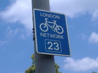
Cycle routes or bicycle route are named or numbered or otherwise signed routes. May go along roads, trails or dedicated cycle paths.
Ausgeschilderte Fahrradroute
Implies:
Impliziert:
Combined with:
Kombiniert mit:
ref=*, network=*, operator=*, name=*
Weblinks in wiki:
Weblinks im Wiki:
rcn_ref=*, signed_direction=yes, type=route, network=rcn, website=*, roundtrip=yes, descent=*, name=*, network=lcn, network:type=node_network, ref=*, route=*, network=*, distance=*, state=*, information=guidepost, from=*, ascent=*, to=*, network=icn, network=ncn, route=bicycle, operator=*, type=network
Related terms:
Verwandte Begriffe:
-
-
trailblazed=✱
Description:
Beschreibung:
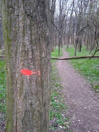
Markings on outdoor paths and trails by signs, markers, poles, cairns or in another way.
Markierungen auf Wegen und Pfaden im Freien durch Schilder, Markierungen, Pfähle, Steinmännchen oder auf andere Weise.
Implies:
Impliziert:
Combined with:
Kombiniert mit:
trailblazed:visibility=*, highway=*
Weblinks in wiki:
Weblinks im Wiki:
marker=*, trailblazed:visibility=*, information=trail_blaze, osmc:symbol=*, trailblazed=no, trailblazed:visibility=horrible, guidepost=*, wiki:symbol=*, highway=*, trailblazed=poles, colour=*, trailblazed=*, osmc:symbol=red:red_round:white_dot, trailblazed=symbols, man_made=cairn, trailblazed=cairns, symbol=*, wiki:symbol=*, tourism=information, information=route_marker, osmc:symbol=red:red_arch, trailblazed:visibility=good, trailblazed=yes, trailblazed:visibility=intermediate, trailblazed:visibility=bad, osmc:symbol=red:red_x
Related terms:
Verwandte Begriffe:
-
-
usage=gathering
Description:
Beschreibung:
Specific pipeline usage dedicated to path leading fluids from tag:substation=field_gathering to tag:substation=central_processing sites
-
Implies:
Impliziert:
Combined with:
Kombiniert mit:
Weblinks in wiki:
Weblinks im Wiki:
substation=central_processing, usage=gathering, man_made=pipeline, substation=field_gathering
Related terms:
Verwandte Begriffe:
-
-
footway=link
Description:
Beschreibung:
A traversable path connecting other highways to enable routing.
Ein begehbarer Pfad, der andere Strassen verbindet, um Routing zu ermöglichen.
Implies:
Impliziert:
Combined with:
Kombiniert mit:
surface=*, wheelchair=*, lit=*
Weblinks in wiki:
Weblinks im Wiki:
footway=access_aisle, footway=link, highway=footway, footway=sidewalk, footway=crossing, surface=*, lit=*, wheelchair=*, service=parking_aisle, highway=residential, highway=service, foot=yes
Related terms:
Verwandte Begriffe:
-
-
mountain_pass=✱
Description:
Beschreibung:
Marks the highest point of a mountain road, railway or path as it passes over a crest.
Der höchste Punkt einer Wegführung, Strasse oder Eisenbahn, die über einen Bergkamm führt.
Implies:
Impliziert:
Combined with:
Kombiniert mit:
Weblinks in wiki:
Weblinks im Wiki:
natural=saddle, name=Stilfserjoch, ele=2760, wikipedia=*, ele=*, name=Passo dello Stelvio, mountain_pass=yes, name=*, name=Brennerpass, ele=1370, opening_hours=*
Related terms:
Verwandte Begriffe:
-
-
mountain_pass=yes
Description:
Beschreibung:
Marks the highest point of a mountain road, railway or path as it passes over a crest.
Markiert den höchsten Punkt einer Wegführung, Strasse oder Eisenbahn, die über einen Bergkamm führt.
Implies:
Impliziert:
Combined with:
Kombiniert mit:
Weblinks in wiki:
Weblinks im Wiki:
mountain_pass=*, ele=*, name=*, natural=saddle, mountain_pass=yes
Related terms:
Verwandte Begriffe:
-
-
route=mtb
Description:
Beschreibung:
MTB (Mountain Bike) routes are named, numbered or otherwise signed routes, designated for mountain biking. May go along roads, trails or dedicated cycle paths.
Mountainbike-Route
Implies:
Impliziert:
Combined with:
Kombiniert mit:
name=*, ref=*, operator=*, network=*
Weblinks in wiki:
Weblinks im Wiki:
highway=*, operator=*, route=bicycle, distance=*, network=*, roundtrip=yes, mtb:scale:imba=0-4, mtb:scale=0-6, route=mtb, network:type=node_network, type=route, mtb:scale:uphill=0-5, ref=*, name=*, ascent=*, signed_direction=yes, descent=*
Related terms:
Verwandte Begriffe:
-
-
surface=rock
Description:
Beschreibung:
Rocky surface of path or other similar object
Felsige Oberfläche des Pfades oder ähnliches Objekt (Übersetzung)
Implies:
Impliziert:
Combined with:
Kombiniert mit:
Weblinks in wiki:
Weblinks im Wiki:
surface=unhewn_cobblestone, surface=sett, surface=gravel, natural=bare_rock, highway=steps, surface=rock, surface=paving_stones, highway=path
Related terms:
Verwandte Begriffe:
-
-
wiki:symbol=✱
Description:
Beschreibung:
OpenStreetMap Wiki Symbol References of Hiking Path Symbols
OpenStreetMap Wiki Referenzen für Wanderwegsymbole
Implies:
Impliziert:
Combined with:
Kombiniert mit:
route=hiking, type=route, route=foot
Weblinks in wiki:
Weblinks im Wiki:
symbol=*, wiki:symbol=Symbol_Jakobsweg.svg, wiki:symbol=TCTsymbolLeafPath64.svg, wiki:symbol=Portuguese hiking symbol-Wrong path.svg, wiki:symbol=Szlak rowerowy niebieski.svg, route=hiking, old_name=The Great Trail, osmc:symbol=*, wiki:symbol=Portuguese hiking symbol-Correct path PR-GR shared.svg, wiki:symbol=Portuguese hiking symbol-Correct path.svg, wiki:symbol=MacGiollophadraig Way.png., wiki:symbol=Trailkilkenny red arrow.svg, wiki:symbol=Stradbally mass rock walk symbol.svg, wiki:symbol=Trailkilkenny green arrow.svg, wiki:symbol=Trailkilkenny purple arrow.svg, wiki:symbol=Portuguese hiking symbol-GR-Turn right.svg, wiki:symbol=TCTsymbolCurved64.svg, wiki:symbol=Portuguese hiking symbol-GR-Wrong path.svg, wiki:symbol=Portuguese hiking symbol-GR-Correct path.svg, wiki:symbol=Szlak rowerowy żółty.svg, wiki:symbol=Ives Trail symbol red.svg, wiki:symbol=Baby blue arrow Ireland.svg, wiki:symbol=Szlak rowerowy zielony.svg, wiki:symbol=TheGreatTrailsymbol64.svg, route=foot, wiki:symbol=TCTsymbolStraight64.svg, type=route, wiki:symbol=Portuguese hiking symbol-GR-Turn left.svg, wiki:symbol=Ives Trail symbol white.svg, wiki:symbol=Portuguese hiking symbol-Turn left.svg, wiki:symbol=Szlak rowerowy czerwony.svg, wiki:symbol=Szlak rowerowy czarny.svg, wiki:symbol=Portuguese hiking symbol-Turn right.svg
Related terms:
Verwandte Begriffe:
-
-
obstacle=✱
Description:
Beschreibung:
Objective obstacles in a path (or highways) that difficult the passability.
Objektive Hindernisse auf einem Pfad (oder Autobahnen), die die Passbarkeit schwierig sind. (Übersetzung)
Implies:
Impliziert:
Combined with:
Kombiniert mit:
Weblinks in wiki:
Weblinks im Wiki:
width=*, maxheight:physical=*, height=*, highway=path, hazard=bump, obstacle=vegetation, waterway=*, barrier=*, surface=wood, bridge=yes, route=ferry, maxheight=*, tunnel=*, barrier=log, hazard=*, highway=*, access=no, obstacle:conditional=no @ Nov-Mar, waterway=lock_gate, obstacle=*, trail_visibility=*, overgrown=*, lock=*, hazard=hole, obstacle_description=*, bridge:movable=drawbridge, tracktype=*, smoothness=*, surface=*, sac_scale=*, intermittent=yes, obstacle=fallen_tree
Related terms:
Verwandte Begriffe:
-
-
aeroway=taxilane
Description:
Beschreibung:
A path for aircraft in an airport that is part of the aircraft parking area or apron
Rollmarkierung auf dem Vorfeld
Implies:
Impliziert:
Combined with:
Kombiniert mit:
Weblinks in wiki:
Weblinks im Wiki:
aeroway=taxilane, aeroway=taxiway, aeroway=parking_position
Related terms:
Verwandte Begriffe:
-
-
disc_golf=hole
Description:
Beschreibung:
The path from tee to the basket
Eine Bahn bei einer Discgolfanlage
Implies:
Impliziert:
Combined with:
Kombiniert mit:
ref=*
Weblinks in wiki:
Weblinks im Wiki:
ref=*, par=*, leisure=disc_golf_course, dist=*, disc_golf=*, disc_golf=hole
Related terms:
Verwandte Begriffe:
-
-
navigationaid=papi
Description:
Beschreibung:
Precision Approach Path Indicator
Präzisions-Anflug Gleitwinkelbefeuerung
Implies:
Impliziert:
Combined with:
Kombiniert mit:
Weblinks in wiki:
Weblinks im Wiki:
aeroway=navigationaid, navigationaid=papi
Related terms:
Verwandte Begriffe:
-
-
historic=hollow_way
Description:
Beschreibung:
Is a path/way which has over time fallen significantly lower than the land on either side. They are created incrementally by erosion, by water and traffic.
Ein Hohlweg ist ein Weg, der sich durch jahrhundertlange Nutzung mit Fuhrwerken und Vieh sowie abfliessendes Regenwasser tief in das umgebende Gelände eingeschnitten hat.
Implies:
Impliziert:
Combined with:
Kombiniert mit:
Weblinks in wiki:
Weblinks im Wiki:
historic=hollow_way, highway=track, highway=path
Related terms:
Verwandte Begriffe:
-
-
footway=residential
Description:
Beschreibung:
A residential pedestrian path
Ein Fussweg in Wohnanlagen
Implies:
Impliziert:
Combined with:
Kombiniert mit:
width=*, incline=*, surface=*, est_width=*
Weblinks in wiki:
Weblinks im Wiki:
access=yes, est_width=*, width=*, access=private, highway=footway, access=permissive, incline=*, footway=residential, surface=*
Related terms:
Verwandte Begriffe:
-
-
safety_rope=✱
Description:
Beschreibung:
Rope as safety measures in alpine hiking paths
Seil als Sicherheitsmassnahmen auf alpinen Wanderpfaden (Übersetzung)
Implies:
Impliziert:
Combined with:
Kombiniert mit:
height=*, length=*, highway=path, sac_scale=*
Weblinks in wiki:
Weblinks im Wiki:
sac_scale=*, rungs=*, safety_rope=4, wheelchair=no, ladder=*, height=*, safety_rope=yes, length=*, highway=path
Related terms:
Verwandte Begriffe:
-
-
assisted_trail=✱
Description:
Beschreibung:
Indicates that the dangerous or difficult sections of a hiking path are secured by technical means like steel cables, fixed ropes, ladders, or rungs.
Zeigt an, dass die gefährlichen oder schwierigen Abschnitte eines Wanderwegs mit technischen Mitteln wie Stahlkabeln, festen Seilen, Leitern oder Sprossen gesichert sind. (Übersetzung)
Implies:
Impliziert:
Combined with:
Kombiniert mit:
Weblinks in wiki:
Weblinks im Wiki:
highway=via_ferrata, highway=ladder, wheelchair=no, rungs=*, sac_scale=*, highway=path, safety_rope=*, ladder=*
Related terms:
Verwandte Begriffe:
-
-
cycleway:surface:colour=✱
Description:
Beschreibung:
Indicates the colour of a cycle path or lane.
Gibt die Farbe eines Radfahrsteifen oder Radweges an.
Implies:
Impliziert:
Combined with:
Kombiniert mit:
Weblinks in wiki:
Weblinks im Wiki:
highway=*, colour=*, cycleway:left=lane, cycleway=*
Related terms:
Verwandte Begriffe:
-
-
educational=✱
Description:
Beschreibung:
Specifies whether a foot or hiking route is an "educational path" or "nature trail"
Gibt an, ob ein Fuss- oder Wanderweg ein "Bildungspfad" oder "Naturpfad" ist (Übersetzung)
Implies:
Impliziert:
Combined with:
Kombiniert mit:
route=foot, route=bicycle, route=hiking
Weblinks in wiki:
Weblinks im Wiki:
name=*, network=*, route=foot, route=*, information=board, route=hiking, type=route, educational=yes, route=bicycle, educational=*
Related terms:
Verwandte Begriffe:
-
-
usage=facility
Description:
Beschreibung:
Specific pipeline usage dedicated to path carrying fluids inside a given facility
Spezifische Pipeline -Nutzung, die dem Pfad mit Flüssigkeiten in einer bestimmten Einrichtung gewidmet ist (Übersetzung)
Implies:
Impliziert:
Combined with:
Kombiniert mit:
Weblinks in wiki:
Weblinks im Wiki:
usage=flare_header, man_made=pipeline, usage=facility, usage=gathering, usage=transmission
Related terms:
Verwandte Begriffe:
-
-
barrier=motorcycle_barrier
Description:
Beschreibung:
A barrier along a path preventing access by motorcycles.
Eine Konstruktion entlang eines Weges, die den Zugang von Motorrädern verhindert
Implies:
Impliziert:
Combined with:
Kombiniert mit:
access=*, wheelchair=*, maxwidth=*
Weblinks in wiki:
Weblinks im Wiki:
cycle_barrier=tilted, wheelchair=*, barrier=cycle_barrier, motor_vehicle=no, access=*, barrier=motorcycle_barrier, maxwidth=*
Related terms:
Verwandte Begriffe:
-
-
cycleway=proposed
Description:
Beschreibung:
Cycle lanes or paths provided on or adjacent to the carriageway.
Fahrradwege oder Wege auf oder neben der Fahrbahn. (Übersetzung)
Implies:
Impliziert:
Combined with:
Kombiniert mit:
Weblinks in wiki:
Weblinks im Wiki:
Related terms:
Verwandte Begriffe:
-
-
leisure=barefoot
Description:
Beschreibung:
Specifies that a path is specifically designed for people to walk barefoot.
Ein speziell angelegter Weg zum Barfussgehen
Implies:
Impliziert:
Combined with:
Kombiniert mit:
Weblinks in wiki:
Weblinks im Wiki:
leisure=barefoot, highway=footway, amenity=kneipp_water_cure, highway=path
Related terms:
Verwandte Begriffe:
-
-
surface=glass
Description:
Beschreibung:
The physical surface of roads, paths and some other objects made of glass.
Die physische Oberfläche von Strassen, Wegen und einigen anderen Objekten aus Glas. (Übersetzung)
Implies:
Impliziert:
Combined with:
Kombiniert mit:
Weblinks in wiki:
Weblinks im Wiki:
building:material=glass, material=glass, surface=grass, roof:material=glass
Related terms:
Verwandte Begriffe:
-
-
route=inline_skates
Description:
Beschreibung:
Inline skate routes are named or numbered or otherwise signed routes. May go along roads, footways or other suitable paths.
Routen für Inline-Skating
Implies:
Impliziert:
Combined with:
Kombiniert mit:
type=route, network=*, operator=*, name=*
Weblinks in wiki:
Weblinks im Wiki:
network=regional, type=network, network=local, type=route, roundtrip=yes, symbol=*, wiki:symbol=*, osmc:symbol=*, rin_ref=12, distance=*, name=*, network=*, network:type=node_network, network=national, ref=*, description=*, colour=*, ref=7, ref=11-12, network=rin, rin_ref=*, operator=*, route=inline_skates
Related terms:
Verwandte Begriffe:
-
-
footway=service
Description:
Beschreibung:
A path used for pedestrian transportation in public spaces
Ein Weg zum Fussgängertransport in öffentlichen Räumen (Übersetzung)
Implies:
Impliziert:
Combined with:
Kombiniert mit:
est_width=*, surface=*, width=*, incline=*
Weblinks in wiki:
Weblinks im Wiki:
width=*, surface=*, highway=footway, footway=service, est_width=*, incline=*
Related terms:
Verwandte Begriffe:
-
-
highway=trail
Description:
Beschreibung:
Using this tag is discouraged, use tag:highway=path, tag:highway=footway, tag:highway=cycleway, or tag:highway=bridleway instead.
Verwenden Sie mit diesem Tag entmutigt. Verwenden Sie Tag: Highway = Pfad, Tag: Highway = Fussweg, Tag: Highway = Cycleway oder Tag: Highway = Bridleway stattdessen. (Übersetzung)
Implies:
Impliziert:
Combined with:
Kombiniert mit:
Weblinks in wiki:
Weblinks im Wiki:
highway=footway, highway=cycleway, mtb:scale=*, highway=bridleway, trail_visibility=*, highway=path
Related terms:
Verwandte Begriffe:
-
-

